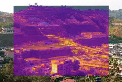
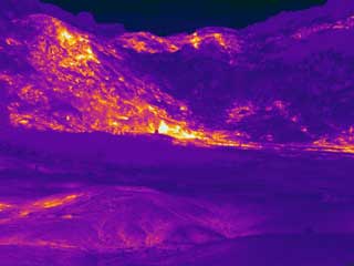
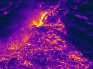
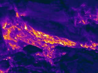
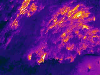
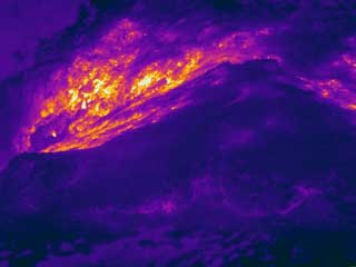
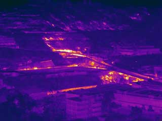
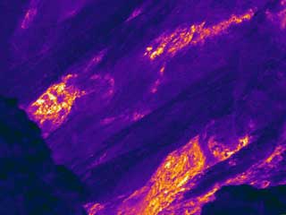
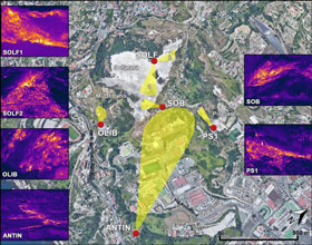
The Thermal Infrared Laboratory (TIRLab) of INGV-Osservatorio Vesuviano manages the thermal infrared permanent volcanic surveillance network (TIRNet) of the volcanic areas of Campi Flegrei and Vesuvio (Italy). TIRNet network is composed of 7 stations which acquire IR frames of volcanic sites characterized by thermal anomalies due to diffuse degassing.
Fabio Sansivero (responsabile)
Francesco Rufino
Alessandro Santi
Solfatara1 station (SF1) acquires IR frames of diffuse degassing area in the SE sector of Solfatara crater including Bocca Grande and Bocca Nuova fumaroles.
Solfatara2 station (SF1) acquires IR frames of diffuse degassing area at the base of NW inner slope of Solfatara crater.
Pisciarelli station (PS1) acquires IR frames of the diffuse degassing area of Pisciarelli at the base of the eastern outer slope of Solfatara volcanic edifice.
Olibano station (OLIB) acquires IR frames of the diffuse degassing area on the southern slope of Monte Olibano lava dome.
SOB station (SOB) acquires IR frames of the diffuse degassing area on the eastern rim of Solfatara volcanic edifice.
Antiniana station (ANTN) acquires IR frames of the diffuse degassing area of Agnano - via Antiniana, at East of Solfatara volcanic edifice.
Vesuvio station (VES) acquires IR frames of the diffuse degassing area of inner western rim of Vesuvio crater.
The first station of TIRNet network was installed on June 2004 at Vesuvius crater and after this date several technological improvements were applied to the network stations. All station are equipped with FLIR SC645/655 infrared cameras at present time. These cameras acquire IR frames at 640x480 resolution in the 7.5-13 μm thermal infrared bandwidth. Sensor accuracy is ± 2°C and thermal sensibility is 30 mK (at 50/60 Hz).
The thermal infrared Remote Monitoring Station
(RMS) performs daily automated acquisition of IR images and
their upload to a server of the INGV-Osservatorio Vesuviano
Surveillance Center in Naples (Italy). The RMS was designed and
developed by the Thermal Infrared Laboratory of the
Osservatorio Vesuviano and both hardware and software are
constantly technologically upgraded.
Detailed description of the hardware schematics of latest
RMS is in Sansivero et al., 2025.
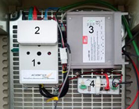
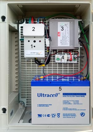
In the figure on the right side are illustrated the main components of the IR RMS:
A FLIR IR camera, protected by a stainless steel
case with Germanium window, and an air Temperature and
Humidity probe are connected to the IR RMS. The probe is
necessary to perform real-time correction of the IR frames acquired by the
FLIR camera. Whole system is controlled by the Python-based ICARO (Infrared Camera
Automation for Remote Observations) control software.
A comprehensive description of ICARO functionalities is provided in
Sansivero et al., 2025.
The Pyton code of ICARO is avaliable to download at:
IR RMS main components
The acquired IR frames are uploaded to the acquisition server in the Osservatorio Vesuviano data center and processed by the automated software A.S.I.R.A. (Automated System for IR Analysis; Sansivero et al., 2025) developed by the OV Thermal Infrared Laboratory. This software extracts surface temperature time-series and heat-flux estimations of the monitored volcanic areas by processing IR data. These time-series values are plotted in the Monitoring Room of Osservatorio Vesuviano to improve volcanic surveillance.
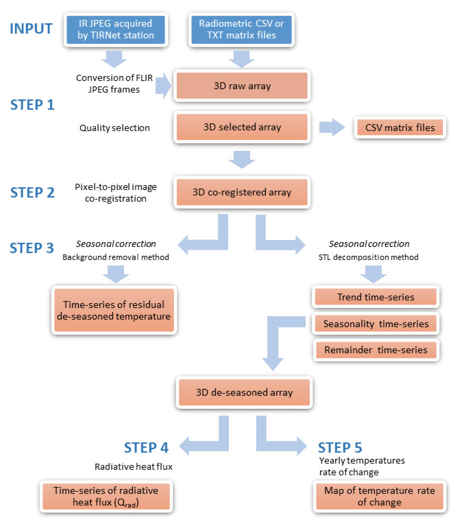
Main data processing phases implemented in ASIRA are illustrated in the following flowchart.
- ASIRA for GNU Octave code -
The GNU Octave version of A.S.I.R.A. (Automated System for IR Analysis)
is an automated software of TIR analysis developed under the Creative Commons Attribution 4.0
International License. The ASIRA processing workflow consists of the following main steps: 1) quality
assessment and exclusion of low-quality TIR frames and archiving of TIR input data,
provided as .txt or .csv matrix, in .mat format files, split in years; 2) co-registration of
all frames with respect to a reference frame to correct possible pixel misalignments; 3)
extraction of continuous time series of apparent temperatures (both maximum and average
values) from user selected areas (ROIs) within the TIR frames; 4) removal of seasonal
components from the temperature time series via background removal or statistical decomposition
methodologies; and 5) evaluation of radiative heat fluxes and area variations in
thermal anomaly.
- Technical user manual of ASIRA -
A comprehensive guide to the use of ASIRA and to its configuration.
Sansivero, F.; Vilardo, G.; Buonocunto C. Development of a Thermal Infrared Network for Volcanic and Environmental Monitoring Hardware Design and Data Analysis Software Code. Sensors 2025, 25, 4141. https://doi.org/10.3390/s25134141
Sansivero, F., Vilardo, G., 2024. Twenty Years of Thermal Infrared Observations (2004–2024) at Campi Flegrei Caldera (Italy) by the Permanent Surveillance Ground Network of INGV-Osservatorio Vesuviano. Remote Sensing, 16(17), 3352. https://doi.org/10.3390/rs16173352Sansivero, F.; Vilardo, G., 2019. Processing Thermal Infrared Imagery Time-Series from Volcano Permanent Ground-Based Monitoring Network. Latest Methodological Improvements to Characterize Surface Temperatures Behavior of Thermal Anomaly Areas. Remote Sens., 11, 553. https://doi.org/10.3390/rs11050553
Vilardo, G.; Sansivero, F.; Chiodini, G., 2015. Long-term TIR imagery processing for spatiotemporal monitoring of surface thermal features in volcanic environment: A case study in the Campi Flegrei (Southern Italy). J. Geophys. Res. Solid Earth, 120, 812–826.
Sansivero, F., Scarpato, G., Vilardo, G., 2013. The automated infrared thermal imaging system for the continuous long-term monitoring of the surface temperature of the Vesuvius crater. Ann. Geophys., 56, S0454.
Phd Fabio Sansivero
(Responsible)